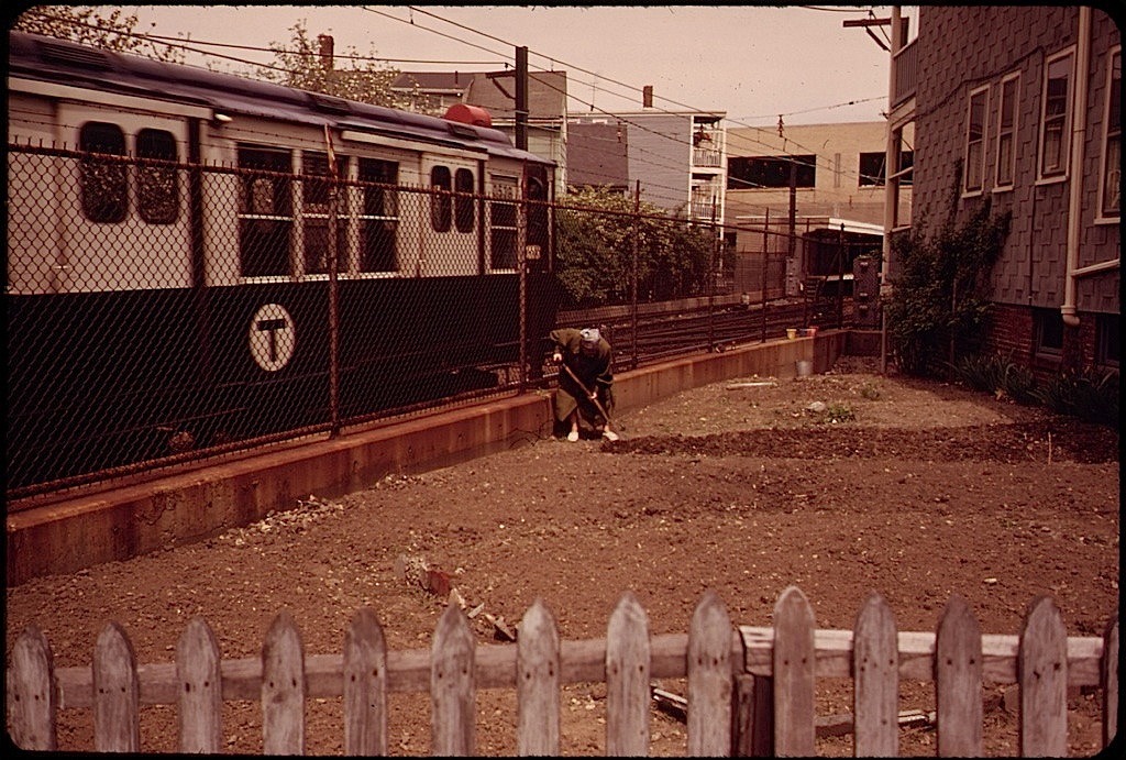
 A woman turns her garden soil while a Massachusetts Bay Transit Authority train rushes past the northeastern side of Neptune Road in East Boston, Massachusetts.
This photo* was taken in May 1973 by Michael Philip Manheim for the DOCUMERICA program of the Environmental Protection Agency.
Manheim captured East Boston, particularly around Constitution Beach and Neptune Road, at a moment of massive expansion of transportation infrastructure, including Interstate 90 (which terminates in East Boston) and an above-ground portion of the city’s rail system (both projects completed in the 1950s). But more than any other piece of infrastructure, Logan Airport was the source of the biggest and potentially most harmful changes.
Logan’s expansion in the mid-1960s led to the removal of a Frederick Law Olmsted-designed park (Wood Island park), and its 1970s expansion led to the displacement of residents on Neptune Road as well as mounting local noise and air pollution issues.
Forty years later, the lively neighborhood Manheim found along Neptune Road hardly exists, replaced with parking lots and runways.
— Mark Byrnes, for the CITYLAB blog of The Atlantic
There are more photos of East Boston by Manheim here.
*Via the U.S. National Archives Commons on flickr.
