A study in steps: Sacromonte

His wandering step
Obedient to high Thoughts, has visited
The awful ruins of old. . .

— Percy Bysshe Shelley, “Alastor

Steps and shrines of Sacramonte, late 1800s, William Henry Jackson, Library of Congress/enclos*ure

Stairway and shrines of Sacromonte, near Amecameca, Mexico, ca. 1880-1897, by William Henry Jackson, via Library of Congress Prints and Photographs Division.

The canopy walk, Nyungwe Forest

13 Moss on tall tree, Nyungwe Park, Rwanda:enclos*ure

Last February, I wrote about our stay at the Nyungwe Forest Lodge.  Recently, however, I realized that I have never given you a look inside the forest.

The Nyungwe National Park, in the southwest of Rwanda, is 393 square miles of mountain forests, swamps, and moorland.

It has over 80 miles of constructed trails, but during our two-night stay at the lodge, we mainly wanted to relax — so we decided to walk the 1.3 mile Igishigishigi Trail, which includes a canopy walkway suspended 197′ above the ground.

The Uwinka Visitor Center

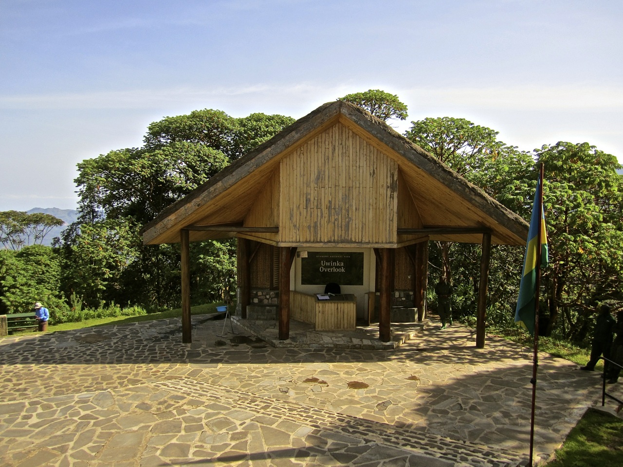
The trail begins at the Uwinka Visitor Center, which was renovated three years ago with U.S. assistance.

The center’s  interpretative display features panels on the mountain rainforest and Nyungwe’s biodiversity, its people, and its role in the Congo-Nile watershed.  The text is in Kinyarwanda, English, and French.

2a Uwinka Visitor Center, Nyungwe Park, Rwanda:enclos*ure

Below are the steps leading to the Igishigishigi Trail.  The shadow with the camera was me, the one on the left was our visiting daughter, who was wondering what she had gotten herself into.

3 Steps to Igishigishigi Trail, Nyungwe Park, Rwanda:enclos*ure

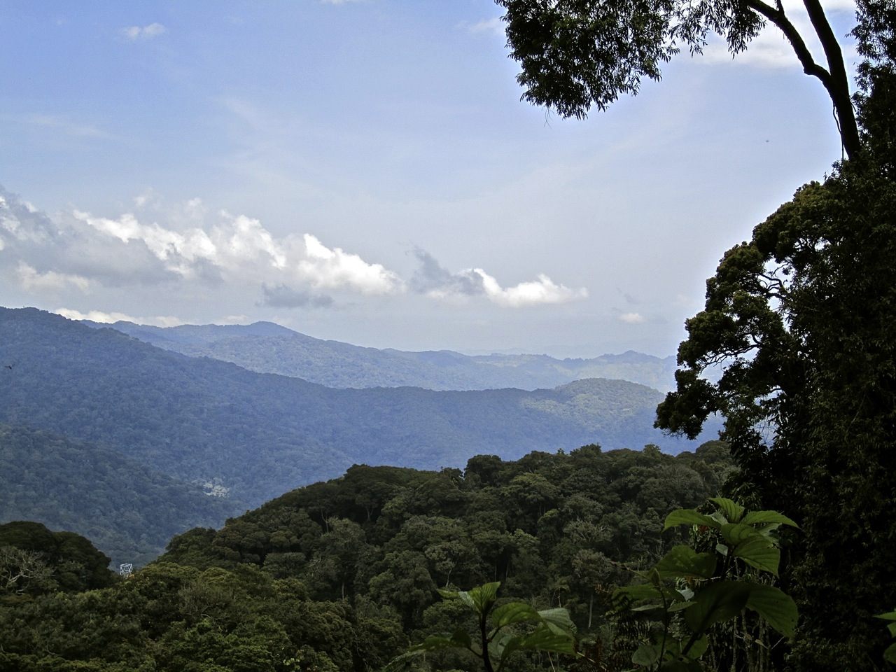
The view near the beginning of the trail is wonderful. Uwinka is at one of the highest points in the park.

7 View, Nyungwe Park, Rwanda:enclos*ure

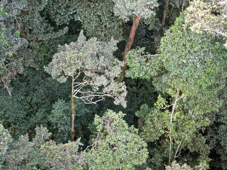
In the left lower corner above, you can just see one of the towers that support the canopy walk.

Below is the trail,

7c Igishigishigi Trail, Nyungwe Park, Rwanda:enclos*ure

which includes several sections of steps.  The trail begins at 8,038′ and descends to 7,530′.

7d Trail steps, Nyungwe Park, Rwanda:enclos*ure

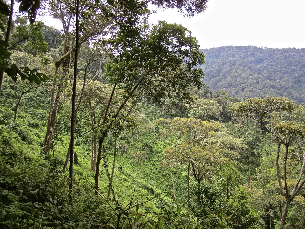
It sometimes passes along more open woodland, below.

7ba Hillside, Nyungwe Park, Rwanda:enclos*ure

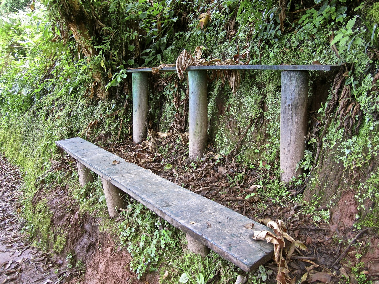
We came across benches from time to time, although this double arrangement, below, didn’t look very comfortable.

14 Trail benches, Nyungwe Park, Rwanda:enclos*ure

Several species of trees are labeled like this one.

8 Labeled tree, Nyungwe Park, Rwanda:enclos*ure

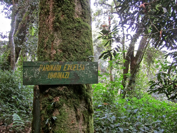
The Parinari excelsa (or Umunazi in Kinyarwanda) grows to heights of 82′ to 131′ with a thick, cauliflower-shaped crown,

8a Parnari excelsa, Nyungwe Park:enclos*ure

way up there.

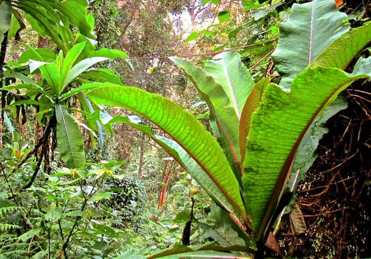
An assortment of ferns, mosses, lichens, and orchids live on the magnificent trees

13b Moss on tree, Nyungwe Park, Rwanda:enclos*ure

and on the forest floor.

13c Forest floor, Nyungwe Park, Rwanda:enclos*ure

One of the more common, and easily recognizable, plants along the trail is the giant lobelia, below.

1 Giant lobilias in the Nyungwe Park, Rwanda:enclos*ure

There are two species of giant lobelias in the park.  I think these are Lobelia gibberoa (or Intomvu in Kinyarwanda).

After the explorer Johannes Mildbraed first saw this plant in Nyungwe in 1907, he wrote:

[It] would have awakened the interest of the veriest dullard at botany. . . .  When I first espied these strange shapes. . . my heart beat fast at the realization of a long-hoped-for sight, a feeling that is comparable only to that of a hunter at the first sight of some rare game.

13c Giant lobelia, Nyungwe Park, Rwanda:enclos*ure

The one above was only a few feet tall, but more mature specimens towered over our heads.

13d Giant lobelias, Nyungwe Park, Rwanda:enclos*ure

After about 45 minutes, we arrived at the canopy walk.

14a Canopy walk, Nyungwe Park, Rwanda:enclos*ure

In the photo below, our guide was explaining to us how the suspended bridges can support two cars, or twenty cars, or five elephants, or something like that.

15a Canopy walk, Nyungwe Park, Rwanda:enclos*ure

Oh, why not. . .

16b Canopy walk, Nyungwe Park, Rwanda:enclos*ure

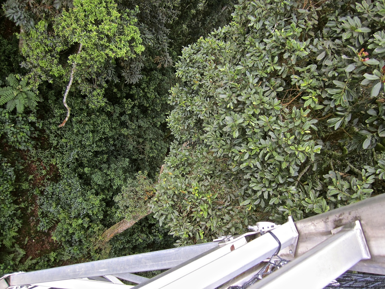
Below:  looking down from the platform of the first tower. . .

18 Look down, Canopy walk, Nyungwe Park, Rwanda:enclos*ure

Below, we started out onto the middle and highest section. . .

19 Treetops, canopy walk, Nyungwe Park, Rwanda:enclos*ure

and began to look down.

20 Look down, Canopy walk, Nyungwe Park, Rwanda:enclos*ure

22 Look down, Canopy walk, Nyungwe Park, Rwanda:enclos*ure

23 Look down, Canopy walk, Nyungwe Park, Rwanda:enclos*ure

It is unsurprisingly difficult to take pictures while standing on a 12″ wide swaying walkway.

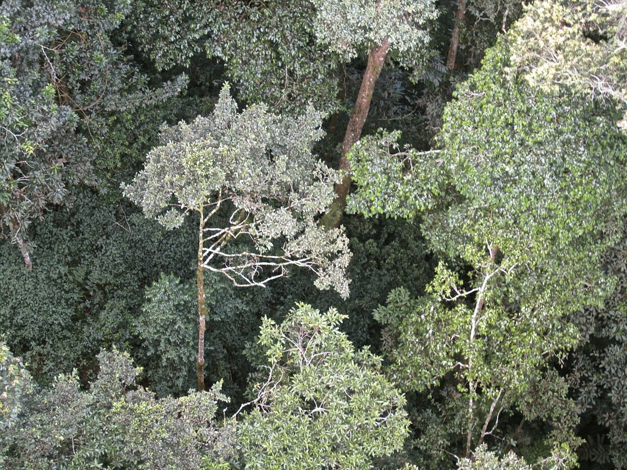
Below, you can see the tops of tree ferns, for which the trail is named (in Kinyarwanda), and we could hear water from a hidden stream.

25Look down, Canopy walk, Nyungwe Park, Rwanda:enclos*ures

A park guidebook says, “The walkway is strong and secure but will provide the visitor with a definite burst of adrenaline.”

26 View from canopy walk, Nyungwe Park, Rwanda:enclos*ure

In the photo above, taken from the walkway, you can see what I think are the young reddish-rose leaflets of Carapa grandiflora.  There is a wonderful full-color field guide on the plants of the park (here*), but, of course, mine was sitting back home on my desk during our trip.  However, I’m sure this was the best thing for my relationships with my husband and daughter, not to mention the guide.

Although the forest is home to many species of birds and monkeys, we did not see any along this trail — possibly because the popular walk is a bit noisy with humans talking.  But we saw both blue and L’Hoest’s monkeys along the road on the drive back to the lodge and from the balconies of our rooms.  And there is another park trail that features groups of chimpanzees.

And the next day, when we were almost out of the park, we spotted this guy, below, and a friend walking along the side of the road (photo by M. Koran).

Baboon in Nyungwe National Park. Photo by M. Koran/enclos*ure

To scroll through larger version of the images, click on ‘Continue reading’ below and on any thumbnail in the gallery.

*Sometimes you can find it here in Rwanda at bookstores or museum shops.  However, they were not selling it at the park or lodge when we were there.
Continue reading “The canopy walk, Nyungwe Forest”

Vintage landscape: Washington Monument, Baltimore, Md.

Great Washington, too, stands high aloft on his towering main-mast in Baltimore, and like one of Hercules’ pillars, his column marks that point of human grandeur beyond which few mortals will go.

— Herman Melville, Chapter XXXV, Moby Dick

Washington Monument, Baltimore, early 19th c., Library of Congress/enclos*ureAbove: Baltimore’s Washington Monument under construction in 1828 (looking north).  A watercolor, ink, and graphite drawing by John Rubens Smith, via the Library of Congress.*

Completed in 1829, the monument was the second one erected to honor George Washington.  (A tower in Boonsboro, Md., was finished first, in 1827.)

The land for the 178′ tower and its surrounding park had been donated by John Eager Howard from part of his estate, Belvidere.  In the late 18th century, Belvidere was often praised for its fine high views, and the monument was originally visible from ships entering the harbor (today, 10 city blocks to the south).

1796 George Beck Baltimore from Howard Park, Maryland Historical Society. Above: Detail of “The View of Baltimore from Governor John Eager Howard’s Garden Park,” 1796, via the Maryland Historical Society and Early American Gardens.

19th c. Washington Monument, Baltimore, Library of Congress/enclos*ureAbove: In 1849, artist unknown.

During the next twenty years, four small squares, one in each direction, were laid out around the monument.  They were originally planted with grass and surrounded by iron fences.  The well-to-do built homes, churches, and cultural institutions around the squares, which became known collectively as Mount Vernon Place.

“It [was] one of the first examples in the United States of a deliberate use of city planning to create a dramatic setting for an existing monument,” according to the Trust for Architectural Easements.

Washington Monument, Baltimore, 1900, Md. Historical Society/enclos*ureAbove: Mount Vernon Place, east side, 1900, photographer unknown.

Mount Vernon Place has undergone several design and planting changes since about 1850, according to the Mount Vernon Place Conservancy.  The photo above and those below show the 1875-76 paths and stone walls of Frederick Law Olmsted’s firm.

early 20th c. Washington Monument, Baltimore, Library of Congress/enclos*ureAbove:  The south side, ca. 1902, by William Henry Jackson (Detroit Publishing Co.). early 20th c. Washington Monument, Baltimore, Library of Congress/enclos*ureAbove: Mt. Vernon Place, north and east sides, ca. 1903, by William Henry Jackson (Detroit Publishing Co.).

early 20th c. Washington Monument, Baltimore, Library of Congress/enclos*ureAbove: Looking north, ca. 1920-1930, photographer unknown.

This last photo shows the work of Thomas Hastings of the architecture firm of Carrère and Hastings.  In 1917, he redesigned the squares in the Beaux-Art style.  According to the Mount Vernon Place Conservancy:

[His] design was an exemplar of City Beautiful-inspired architectural and landscape design, which called for symmetry, uniformity and axiality.

Hastings utilized white marble to harmonize his new work with the existing monument, and retained the tradition in the east, west and north squares of matched trees framing the squares. After his hardscape work was completed, the trees in all of these squares were replanted to ensure they would mature uniformly, creating and maintaining a crisp border on their edges. Hastings supported this wholesale replanting as necessary for the future integrity of his design.

In the south square, however, he retained some of the existing large trees and shrubs to frame out a newly positioned statue of Lafayette.

It used to be possible go inside the monument and climb to the top.  I did it about 12 years ago.  There are 228 very claustrophobic steps.  The structure has not been open to the public for the last three years, however.


*All the images here are via the Library of Congress Prints and Photos Division, except the third, fourth, and last, which are via the Maryland Historical Society.

Vintage landscape: clear sailing

Children with sailboats on the Reflecting Pool, 1920s, Library of Congress/enclos*ure“Children with sailboats at Reflecting Pool, Lincoln Memorial in background, Washington, D.C.,” in the 1920s. Photographer unknown, part of the National Photo Company Collection, Library of Congress Prints and Photographs Division.

Unfortunately, these little boats would be swamped today, as Washington is in the grip of tropical storm Andrea.

Thunder blossoms gorgeously above our heads,
Great, hollow, bell-like flowers,
Rumbling in the wind,
Stretching clappers to strike our ears . . .
Full-lipped flowers
Bitten by the sun
Bleeding rain
Dripping rain like golden honey—
And the sweet earth flying from the thunder.

— Jean Toomer, “Storm Ending

Vintage landscape: Locke garden

.    .    .   I keep
a beautiful garden, all abundance,
indiscriminate, pulling itself
from the stubborn earth.   .   .   .

Paisley Rekdal, from “Happiness

Historic American Buildings Survey, Town of Locke, CA/enclos*ureA garden plot in a communal garden, Town of Locke, Sacramento County, Ca. Photo by Jet Lowe, April 1984, part of a Historic American Buildings Survey (HABS) of the town, via Library of Congress Prints and Photographs Division.

From the 1984 HABS report:

Locke, California, is a small, rural Chinese ghetto on the Sacramento River.  It was developed in the early 20th century to serve Chungshan Chinese laborers who worked in the fruit orchards and vegetable fields in California’s Delta region. Today, virtually all Chinese communities in America are urban enclaves.  By contrast, Locke has remained an unincorporated village since its founding in 1915.  For this reason, it is unique within the United States as the only extant rural Chinese community still occupied by Chinese people.

Today, the population of Locke is 70 to 80 people, about 10 of whom are of Chinese descent.