The Sunday porch: Dyess Colony

Porch, Dyess Colony, Arkansas, 1940, Library of Congress
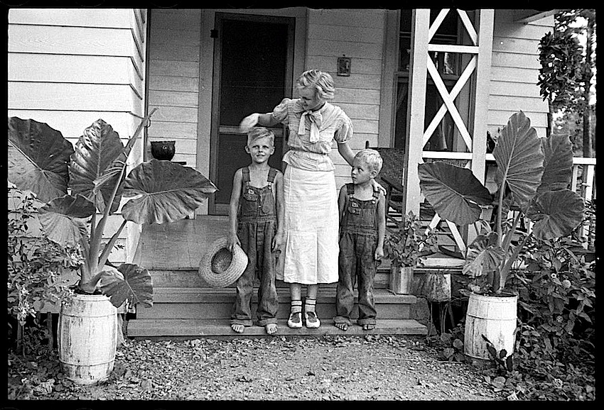
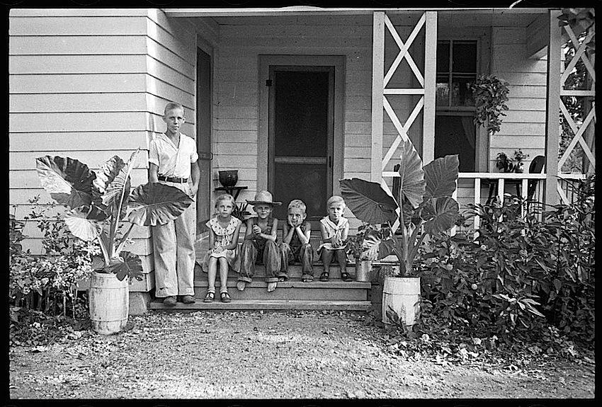
Beautiful elephant ears. This porch belonged to a farming family who were “resettled” in “Colonization Project No. 1” in Mississippi County, Arkansas.

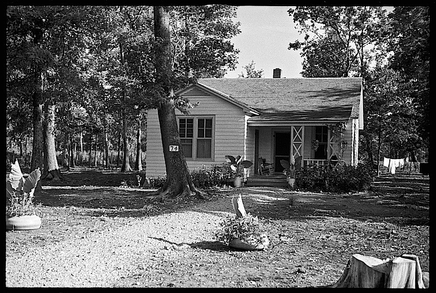
The photos* were taken in August 1935 by Arthur Rothstein. He was on assignment for the U.S. Farm Security Administration.

Children, Dyess Colony, Arkansas, 1940, Library of Congres

The government-sponsored agricultural community had just been established the year before — the brainchild of local cotton planter William Reynolds Dyess, who was also Director of the Arkanasas Emergency Relief Administration.

Family, Dyess Colony, Arkansas, 1940, Library of Congres

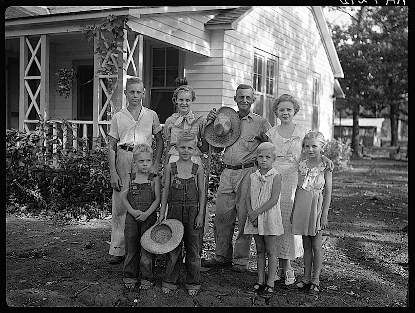
Dyess wanted to provide aid to displaced tenant farmers and sharecroppers. His idea was to put 800 families on 20 to 40-acre uncleared bottomland plots with new houses.

Dyess Colony, Arkansas, 1940, Library of Congres

The project — scaled back to 500 families — was underwritten by the New Deal Federal Emergency Relief Administration. (It was absorbed by the Farm Security Administration in 1944 and made independent of the federal government in 1951. )

“The colony was laid out in a wagon-wheel design, with a community center at the hub and farms stretching out from the middle. . ,” according to the online Encyclopedia of Arkansas. “Each house had five rooms with an adjacent barn, privy, and chicken coop. . . , plus a front and back porch.”

Another Dyess Colony House, Arkansas, 1935, Library of Congress
Another colony house with a mass of flowers along the front path.

Dyess was killed in a plane crash in 1936, and the colony was given his name.

Among the resettled farmers — all of whom were white — was the father of country singer Johnny Cash.  Cash lived  in house #266 from the age  of three until his high school graduation in 1950.

Today, Arkansas State University has restored the Cash home (open to the public) and is working on an adjacent original colony home, as well as the administration building and theater.

Sharecropper's house, Dyess Colony, Arkansas, 1935, Library of Congress

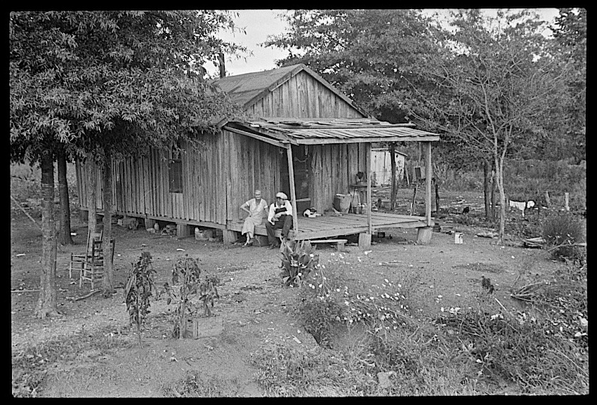
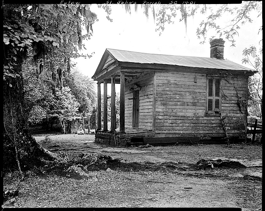
The 1935 photo above by Ben Shahn was captioned, “Sharecropper’s house optioned. Dyess Colony, Arkansas.”  I’m not sure what that means, but the picture gives an example of original local farm housing.

I like the small semi-circle of trees and the two chairs facing out on the left side.


*All photos but the last were by Rothstein, taken in August 1935. All are via Library of Congress Prints and Photographs Division.

Vintage landscape: food cellar

Food storage, 1940, Wabash Farms, Library of Congress“Food storage cellar, Deshee Unit, Wabash Farms [Cooperative], Indiana,” May 1940, by John Vachon, via Library of Congress Prints and Photographs Division.

I found the preserves in the cellar. . . .

The black raspberries were still
delicious, each cluster
burning like years in the brain.

— Michael Waters, from “Preserves

Life in gardens: Woodbine

Woodbine, Iowa, 1940, J. Vachon, Library of Congress“Planting a garden in the backyard, Woodbine, Iowa,” May 1940, by John Vachon, via Library of Congress Prints and Photographs Division (both photos here).

Woodbine, Iowa, 1940, Library of Congress

In the spring of 1940, John Vachon was on assignment for the Farm Security Administration in the Midwest.

. . . I photographed Spring – clothes blowing on the wash line, kids playing marbles, women planting backyard gardens, blossoms on trees.

— John Vachon’s journal

Woodbine is a town of about 1,400 people on the Boyer River.  It was named for the woodbine vine (Parthenocissus vitacea) by the wife of the first postmaster, according to the community’s website.

The banks of Flat Creek

This slideshow requires JavaScript.

May 2, 2010, at Flat Creek near Beatrice, Alabama, an infrared photograph by Carol M. Highsmith, via the Carol M. Highsmith Archive, Library of Congress Prints and Photographs Division.

for the creek racks
strongest in springtime when everything’s liquid,
tightroping over the rocks
in the plashing braid. . .

Jonathan Galassi, from “Flow

The Sunday porch: Eutaw

Eutaw, S.C., 1938, Library of Congress“The Lodge” at Eutaw Plantation, Berkeley County, South Carolina, 1938, by Frances Benjamin Johnston, via Library of Congress Prints and Photographs Division.

Eutaw Plantation, South Carolina, 1938, via Library of Congress
The plantation was established by William and Elizabeth Sinkler in the early 1800s.  Their descendants owned it until the 1940s, when the South Carolina Public Service Authority flooded the area to build the Santee Cooper hydroelectric project.  The estate now lies beneath Lake Marion.

The Lodge — built to resemble a Greek temple — was used as a medical office by a physician member of the family.

I came to explore the wreck. . . .
I came to see the damage that was done
and the treasures that prevail.

Adrienne Rich, from “Diving into the Wreck