The Sunday porch: County Armagh

Bridget and Maynard Sinton at their family home of Ballyards, County Armagh, June 17, 1921, by H. Allison & Co. Photographers, via Public Record Office of Northern Ireland Commons on flickr.

That retractable striped awning emerging from the terrace roof looks very sleek and was brand new.  A ca. 1920 photo of the house in this biography of the children’s father shows the terrace with no cover. (You can read a brief history of awnings here.)

Ballyards was built in 1872 and sold to the father, a linen manufacturer, in 1908. He almost doubled its size and called it “Ballyards Castle.”

The children playing in a sandpile. (This photo has been printed in reverse from the others.)

Maynard was killed in WWII, but Bridget (age 7 in these photos) lived until 1975.

Among daisies

Children in daisies, Library Company of PhiladelphiaWallace and Dot Boyd, Fossie, and “Mother,” with “Uncle Phil” (standing) in a field of daisies. ca. 1900, one half of a stereographic portrait by an unknown photographer, via Library Company of Philadelphia Commons on flickr.

Cheshire County, N.H.


“Ladies playing croquet,” probably Cheshire County, New Hampshire, ca. 1900, by Bion Whitehouse, via Keene Public Library and the Historical Society of Cheshire County Commons on flickr.

Technically, they are playing roque, an American variant* of croquet, which is played on a hard sand or clay surface. Introduced in the late 1880s, it was extremely popular in the first few decades of the 20th century — and an Olympic sport in 1904 — and then almost entirely disappeared after the 1950s.

The roque grounds.

The photo above was published between 1900 and 1919, photographer unknown. It is part of the Termaine Arkley Croquet Collection and via UBC (University of British Columbia) Library Digitization Centre Commons on flickr.

There’s also a photo of 1918 roque grounds in Florida here.


*There is also a modern game of beach croquet.

The Sunday porch: Estero, Florida


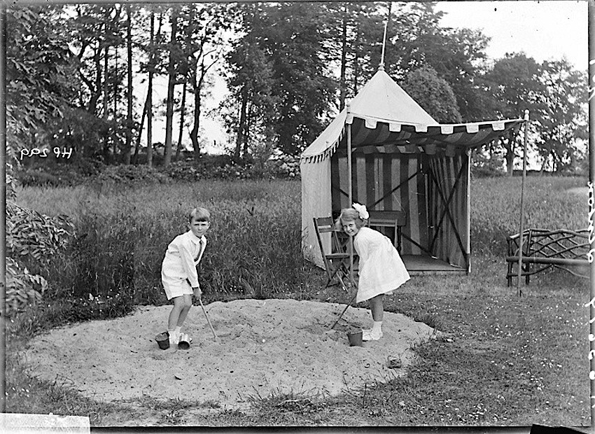
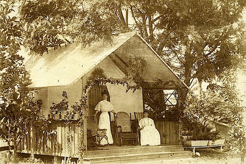
“Tent house on Koreshan property in Estero, Florida,” 1895, via Koreshan Unity Collection, Florida Memory Commons on flickr (State Library and Archives of Florida).

The Koreshan Unity was a late 19th and early 20th century utopian community whose members believed in a god that was both male and female, as well as in reincarnation, celibacy, collectivism, equality of the sexes, and cellular cosmogony.* It was founded by Cyrus Teed in upstate New York in the 1870s, and later there were also followers in Chicago and San Francisco. In 1894, the community began moving to a donated 320-acre property in Estero, Florida. During the next decade, it purchased over 5,000 additional acres and began building a settlement that “included a sawmill, cement works, bakery, machine shop, general store, art gallery, symphony, theater troupe, plant nursery and more,” according to USA Today. Its population peaked at 250 residents between 1903 and 1908; the majority were well-educated middle-class women, seven of whom managed the day-to-day affairs of the commune.

When Teed died in 1908 — and his body was not resurrected as he had promised — the commune began to decline; there were 10 members left in 1948. The last Koreshans deeded the site of its village to the state of Florida in 1961. It is now a state park.


*”Among the most interesting beliefs of Koreshan Unity was the cellular cosmogony, or the hollow earth,” according to Florida Memory.  “According to the cellular cosmogony, the earth was not a convex sphere but instead a hollow, concave cell containing the entire universe with the sun at its center and Earth’s populace living on the inside surface of the hollow cell.”
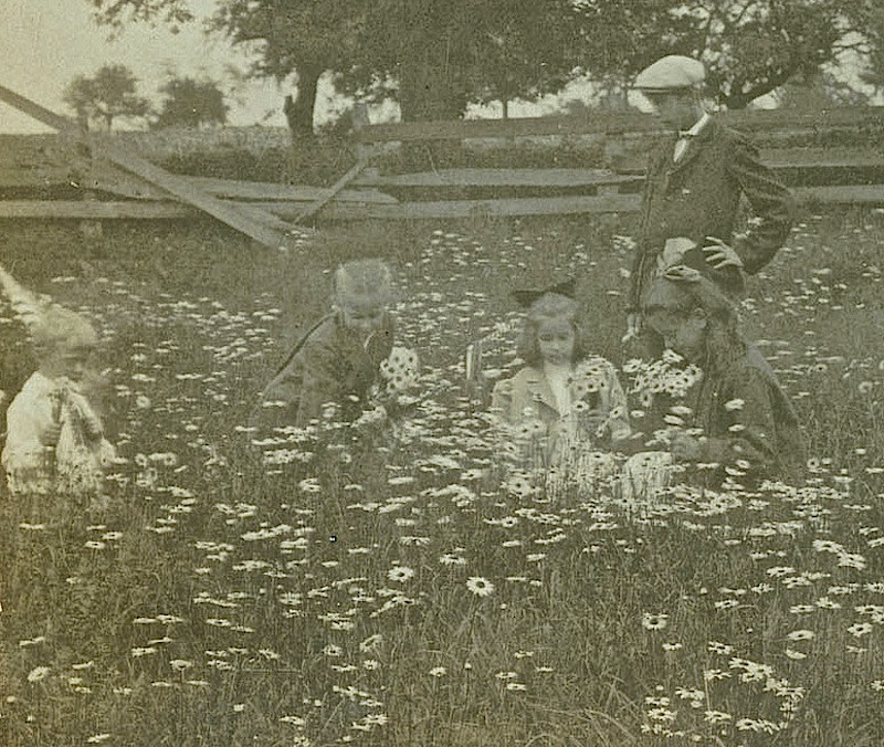
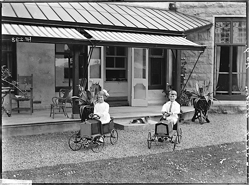
Ronde kom

Round enclosure on Eeuwigelaan (street) in Bergen, The Netherlands, 1926, by A. J. Bondavia Archief Alkmaar Commons on flickr.

I have been wondering about the purpose of this really nice rustic fence in a wooded area (there’s another view here). In a much larger version of the photo, you can see barbed wire all around the top rails. The ground inside has either been dug out or worn away.  There are two benches nearby, with more barbed wire fencing behind them. What appears to be a road in the background is actually a canal. (And you can also see that the man standing on the right is wearing wooden shoes.)

It could have been the site of a large tree of special local significance, which then died and was removed. Or the spot of some other removed shrine or monument.  But why not take away the fence and fill the hole after dismantling what was inside?  Then I thought it might have been the small crater itself that was important — perhaps the remains of a WWI shelling in the area.

Today, this street is lined with very large homes.

ADDENDUM:  Nope, wrong all round. 🙂 Please see the very interesting comment below.