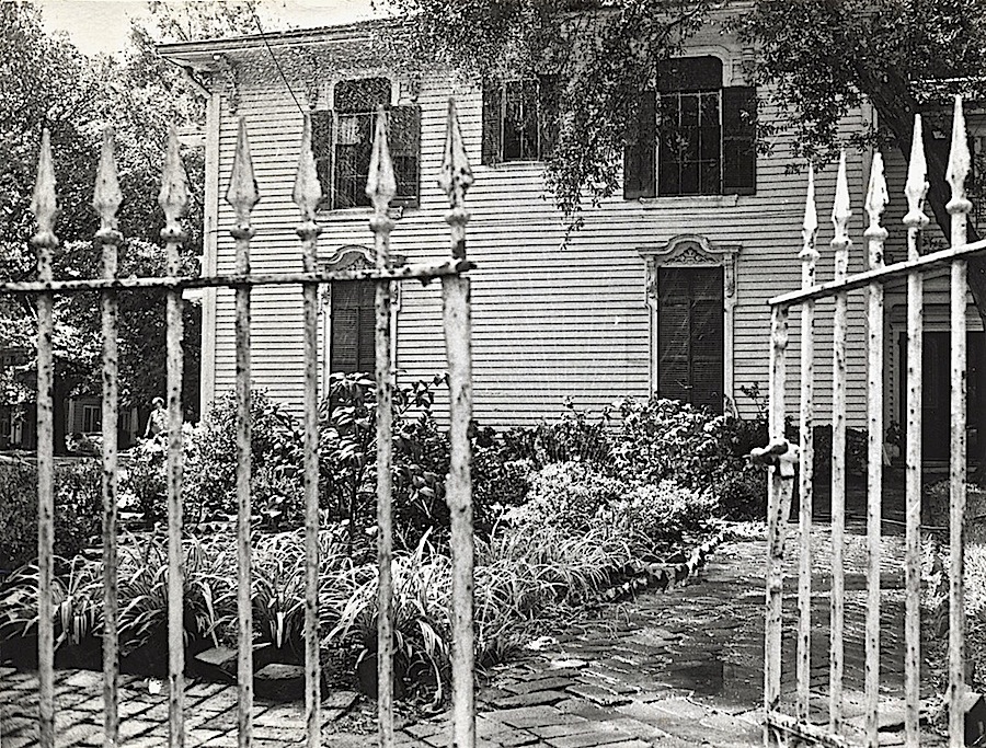
“Gate to the Hamilton residence. Bay St. Louis, Mississippi,” c. 1901, Detroit Publishing Co., via Library of Congress Prints and Photographs Division.*
You can scroll through larger versions of these photos by clicking on ‘Continue reading’ below and then on any of the thumbnails in the gallery.
*All photos here were taken in Bay St. Louis, Mississippi, c. 1901, by Detroit Publishing Co., via Library of Congress Prints and Photographs Division.
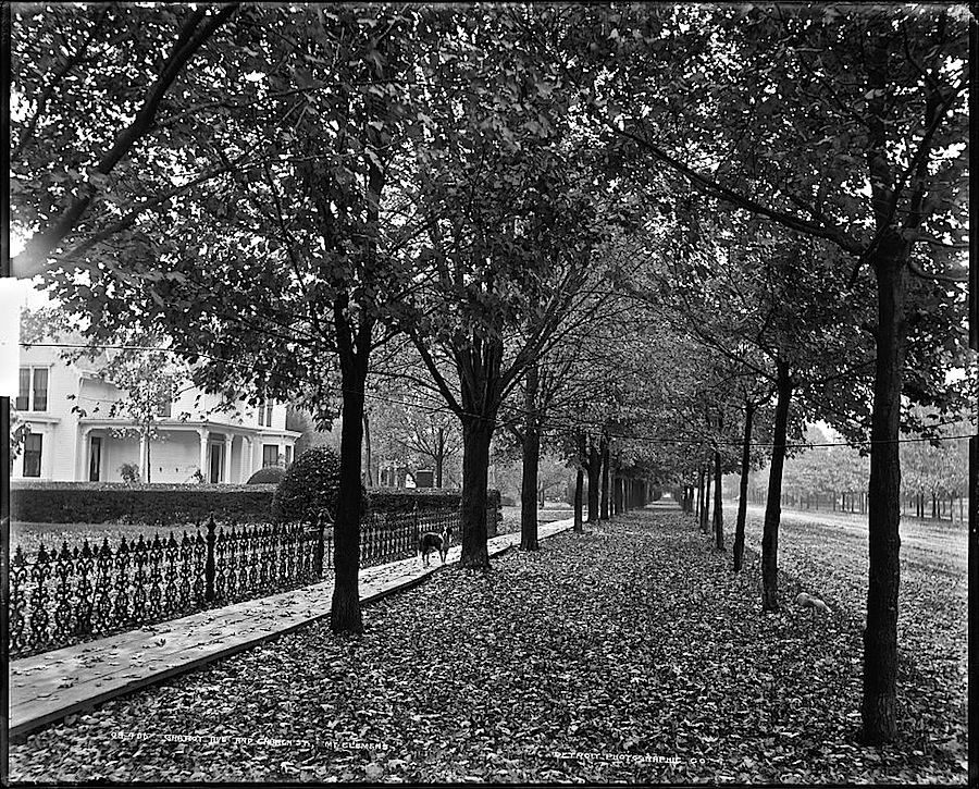
“Gratiot Avenue and Church Street, Mount Clemens, Michigan,” between 1880 and 1899, by Detroit Publishing Co., via Library of Congress Prints and Photographs Division.
From the 1870s until World War II, Mount Clemens attracted film stars and the wealthy to its mineral baths.
There seems to be a potted oleander on the left side.
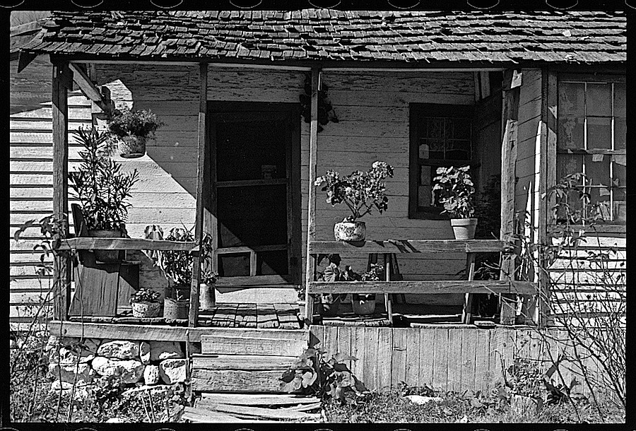
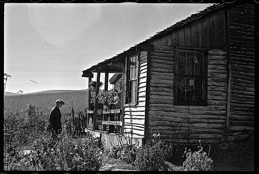
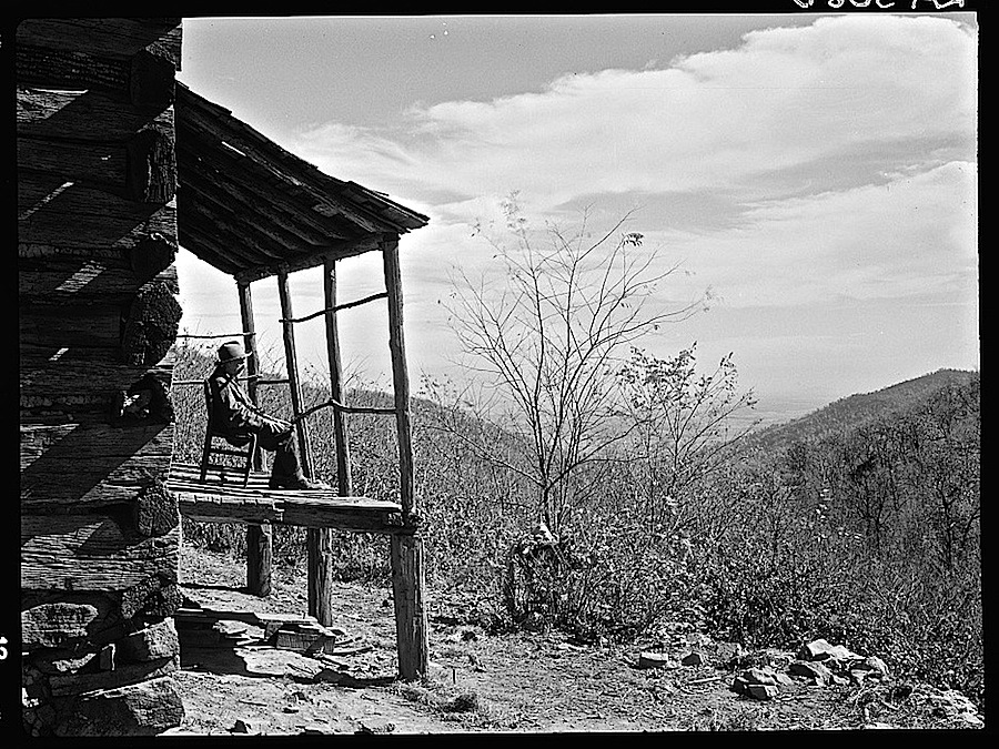
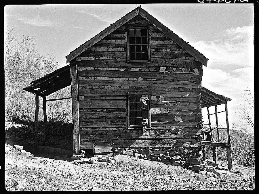
The front porch of a home of the extended Nicholson family of Nicholson Hollow (top three images) in Shenandoah National Park, Virginia, October 1935.*
The Shenandoah National Park is a narrow strip of supremely lovely wilderness along the edge of the Blue Ridge Mountains in Virginia. It begins at Front Royal, about 75 miles west of Washington, D.C., and ends west of Charlottesville.
In order to create a fully “natural” environment, over 450 families were moved out of the park area under the process of eminent domain. Most were small farmers who had been portrayed in a widely publicized 1933 sociological study as desperately poor, primitive, and cut off from 20th century society.
After they were gone, the Civilian Conservation Corps destroyed their homes and outbuildings. The only structures saved were some log houses and rail fences around Nicholson Hollow.
In the mid 1990s, the National Park Service sponsored an archaeological survey of 88 pre-park human settlements in Nicholson, Corbin, and Weakley Hollows.**
The findings of the study strongly refuted the earlier claims that the families (who were indeed often poor) were cut off the modern world. Researchers found china plates, mail order toys, 78 RPM record fragments, pharmaceutical bottles, and automobile parts.
Porch view of Corbin Hollow from one house of the Corbin family (above and below).
The Corbins were very hard hit by the Depression-years decline of the nearby Skyland Resort, which had previously given them employment and a market for their crafts.
There are two very good papers on the displaced people of Nicholson and Corbin Hollows on the National Park Service website, here and here.
Above: another Corbin Hollow farm.
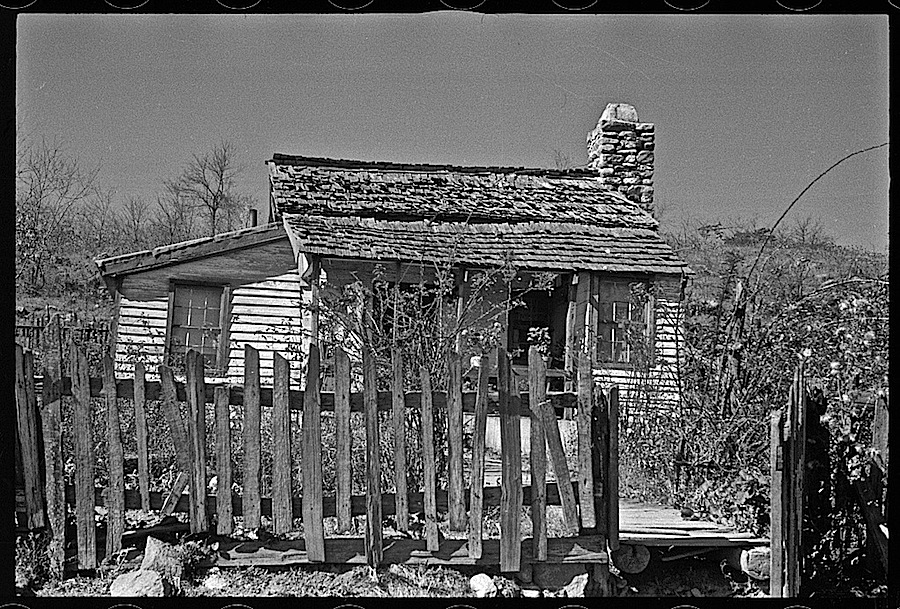
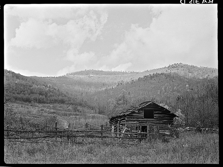
Above: an abandoned house in Nicholson Hollow.
More of Rothstein’s Shenandoah images are here. Recording the last days of the park’s human inhabitants was his first assignment with the Resettlement Administration.
*All the photos here by Arthur Rothstein, in 1935, via Library of Congress Prints and Photographs Division.
**In 2000, not long after the study was completed, a forest fire destroyed all but two of the remaining above-ground buildings.
 “Gate to the Hamilton residence. Bay St. Louis, Mississippi,” c. 1901, Detroit Publishing Co., via Library of Congress Prints and Photographs Division.*
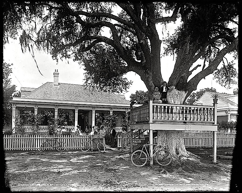 “Harry’s villa.”
 “Shoo-fly at Madame Boyle’s.” (“Harry’s villa” and “Madame Boyles” seem to be the same cottage.)
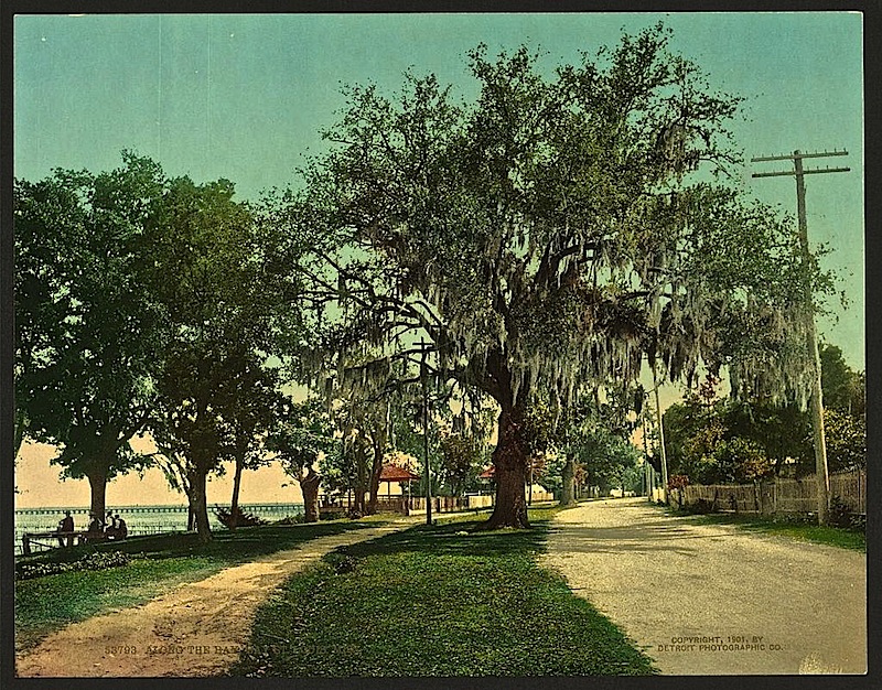 “Along the bay,” a photochrom print.